


The Sawmill Branch Trail
The Sawmill Branch Trail in Summerville, South Carolina, is a bike and walking trail that follows along side the old Sawmill Branch Canal.
The final section is now finished and runs from East Richardson Avenue in the North, close to the center of Downtown Summerville.
From that point there is now close to 7 miles of smooth paved bike path, about 12 or 15 feet wide that will take you to the South End of Old Trolley Road, near Dorchester Road.
Out and back on this trail will give you 14 miles of motor traffic free riding. Where the path crosses the busy Gahagan Rd, Old Trolley Rd, and Bacon’s Bridge Rd, in each case the path goes under a bridge, so there is no stopping or slowing.
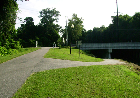
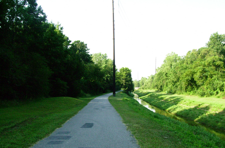
The photo above shows the approach towards the North End of Old Trolley Road.
Here you have the option of going right under the busy four lane Old Trolley and on towards Richardson Ave. Or you can go straight and turn right on Old Trolley; there is a busy intersection at Bacon’s Bridge Rd., but there is a traffic light at this point.
Once past Bacon’s Bridge, Old Trolley Rd., has a bike lane its entire length. You can ride to the South End and turn right on Cross Creek Drive, and join up with the bike trail again. This makes about an 8 or 9 mile loop. (See map below.)
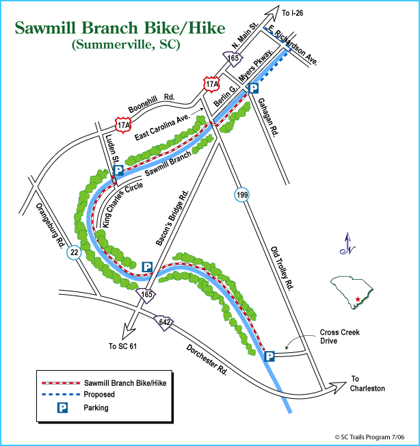
There are 4 different parking areas. My favorite is Luden Street, a quiet residential neighborhood. The trail switches from one side of the canal to the other at this point; don’t go straight across from the car park as the paved trail on that side runs out in about 200 yards.
The trail switches sides at another point just after you go under Old Trolley Road; again this is on a quiet street with little traffic.
A word of warning as you go under the bridges; earlier this summer, some vandals piled large rocks from the canal bank, across the path, under the Old Trolley Rd. Bridge. When you come out of the bright sunlight it is quite dark and hard to see.
An older man, a regular user of the path, hit these rocks, fell heavily, and was hospitalized as a result of his injuries. There was just this one incident and I have since seen the police patrolling the path from time to time.
 Unfortunately, the local kids also love to break glass bottles on the path too, usually thrown from the bridges above.
Apart from these unfortunate but somewhat isolated incidents, I can highly recommend this trail.
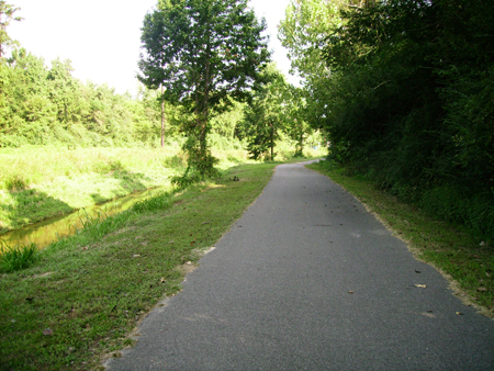
Much of the trail is shaded by trees, which is great on a hot day. You will see Blue Herons and Egrets in the water.
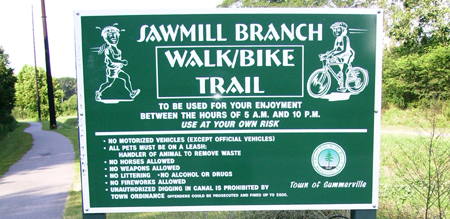
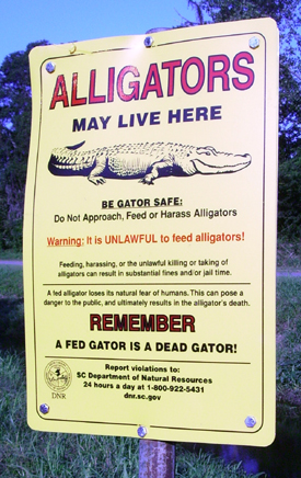
There are warning signs saying “Alligators may live here.” But I haven’t seen any yet.
Here are some more photos.
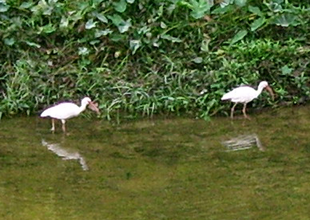
(Above.) Egrets; one of the more common birds you will see on the trail

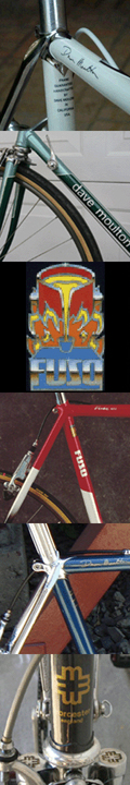
 Dave Moulton
Reader Comments (10)
Looks great. You're lucky to have something like that locally. I think there are some bike paths in Scotland but they're few and far between.
Gorgeous photographs. Looks like it would be a lovely ride. I hope that combined with the bike lane road, this trail can be used by people to get around the city. My friend recently started using a trail to get to work that is considered purely recreation by most, but works for her. Although it adds several miles to her commute, it is much safer than the big suburban roads.
Nice. There should be more of these. In NYC, Mayor Bloomberg insists that he is pro-bike, yet he refuses to make Central Park off-limits to cars. There is a slotted no-car schedule of before 7AM, after 10AM and before 3PM, and then after 7PM, but with winter coming, the morning and evening hours are meaningless. And even during the 10AM-3PM period, taxis are allowed into 1/4 of the park from 6th Ave. north to 72nd St. Add in pedicabs, horse carriages, runners, walkers and tourists with no sense of direction, & accidents are a daily occurrence. Makes no sense whatsoever, but there you go. Welcome to NY!
BTW, those two birds in the photo are not egrets but white ibis. The difference most clearly seen is the bill. On an egret (and there are several types) the bill is dark or black and straight like a dagger. These are pinkish/reddish and curved like a sickle, making them ibis.
Looks like a nice trail, even with the alligator warnings.
We're lucky here in the Seattle area to have quite a few trails to ride on. I commute almost daily on the Burke-Gilman Trail, a very well used trail right into Seattle. If more trails like this existed, more people would commute for sure.
On a semi-related note - I commute on a Ibis, though not the feathered version.
Used this trail on 5/23 - At the lower end near cross creek drive there were 3 enormous Wood Storks grazing on underwater plants/algae - truly impress birds...Along with the usual Ibis and a lesser blue heron.
It's a great trail. I used to ride the section leading to the back side of the YMCA and the Summerville Soccer Club as a kid before it was paved. Recently however, I drove back out to Summerville to take a ride on the trail and hit some of the glass you mentioned a few miles in resulting in a flat. It's a shame that a few people can ruin the experience for the rest of us, but I plan on going back out sometime soon to try and ride the full loop.
I'd agree with the thoughts you've put down, Dave. The Sawmill Branch trail is largely a delight to tackle on foot or two pedaled wheels. As a former Summerville resident, I remember when it used to extend no further from Crosscreek Drive to the back of the Irongate subdivision. How nice that the city/county has extended it out as far as they did, and made it very walker/jogger/biker safe.
Any idea how long the distance is from Trolley to Luden?
Eric,
I would estimate about 1 1/2 miles.
Dave
I love this trail. I live in downtown Summerville and can easily access the Richardson end in about a mile. That gives me about a 15 mile round trip to the YMCA end that is (nearly) traffic free! There are only two street crossings that briefly slow me down. Other crossings go under the bridges. The views, wildlife, shade, and the friendly users, all make this an excellent flat trail for families.