Dave Moulton

Dave's Bike Blog

Award Winning Site

More pictures of my past work can be viewed in the Photo Gallery on the Owner's Registry. A link is in the navigation bar at the top

Bicycle Accident Lawyer


Powered by Squarespace
Search Dave's Bike Blog


 Watch Dave's hilarious Ass Song Video.

Or click here to go direct to YouTube.


A small donation or a purchase from the online store, (See above.) will help towards the upkeep of my blog and registry. No donation is too small.

Thank you.

Join the Registry

If you own a frame or bike built by Dave Moulton, email details to list it on the registry website at www.davemoultonregistry.com

Email (Contact Dave.)

 If you ask me a question in the comments section of old outdated article, you may not get an answer. Unless the article is current I may not even see it. Email me instead. Thanks Dave

Entries in Lowcountry Bike Rides (20)

Monday
Apr232007

I Rode to the Edge of America and Back

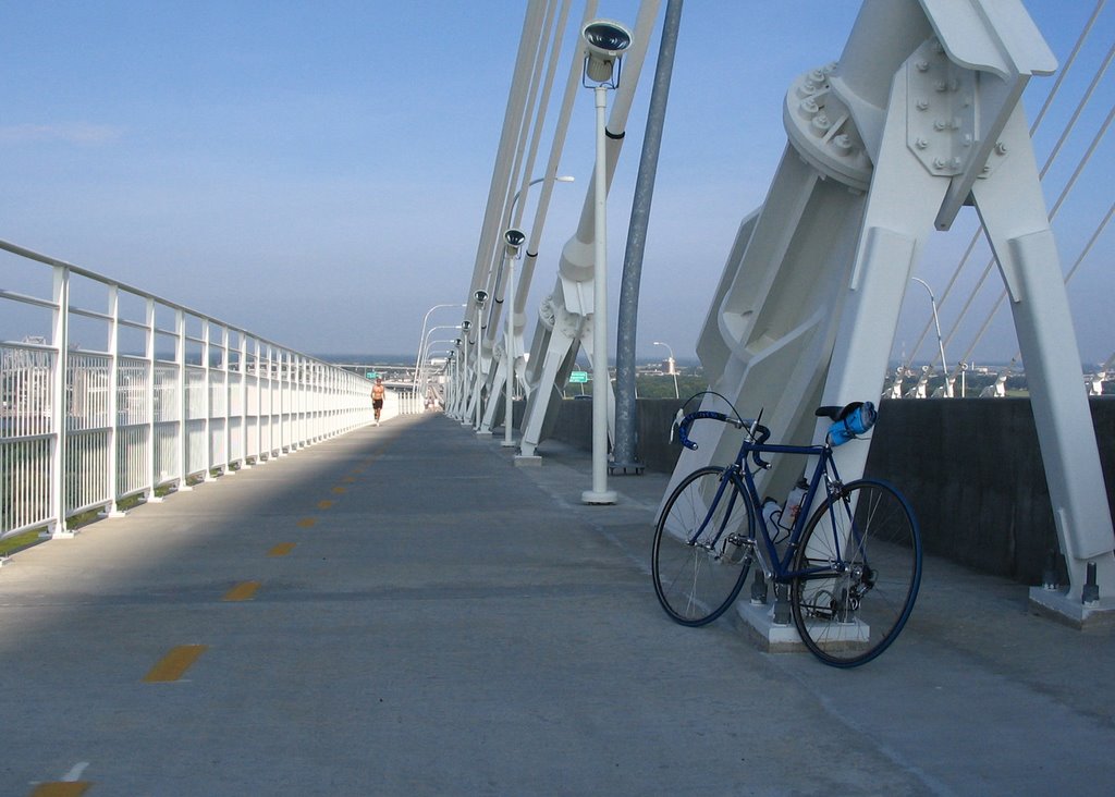
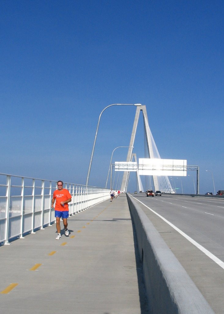
Early last December I rode my bike to Folly Beach. A long narrow barrier island, close to Charleston, known to the locals as “The Edge of America.” It was a beautiful sunny day, temperature in the eighties, with a cooling breeze.


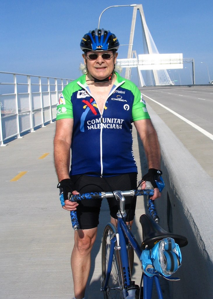
I stopped to take some pictures of my bike on the pier; they were never posted here (until now) because two days later I would be involved in an accident and my frame was wrecked.

Just five weeks ago I started riding again; I’ve been riding three days a week, 25 to 30 miles each day.

Yesterday was an almost identical day to the one when I last rode to Folly Beach. Temperature 81 degrees, with a light breeze; perfect riding weather.

That day last December I was flying, I really felt I was starting to find form. I decided to do the ride again to compare my fitness level with that before my accident.

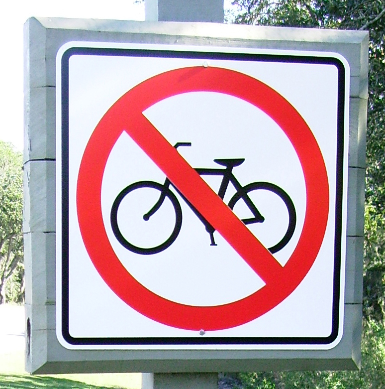
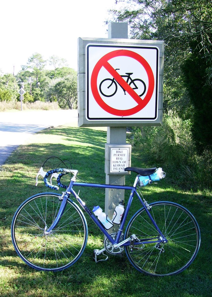
I didn’t take the direct route because Folly Road is narrow and highly congested, especially on a warm, sunny day when everyone heads to the beach. Instead I headed south on Savannah Hwy. actually going away from Folly Beach.

Left on Main Road an over the Stono River bridge. Left again on Rivers to Maybank where another left took me over the Stono River for a second time. Then a right on Riverland Avenue; a pleasant road to ride on, shaded by old growth live oak trees.


A long way around but worth it because when Riverland finally merges with Folly Road, the road is much wider at this point and in a few miles there is a bike lane.

A turn around at Folly Beach without stopping and I headed back the exact same route. About fifty miles round trip done in three hours; 15 minutes slower than when I did the same ride last December.

It appears I have not quite reached my previous form, but I’m getting there.

Thursday
Nov302006

Kiawah Island Bike Ban: Part 2


Apparently I made a wrong assumption when I saw the above sign, (See my previous post and the comments.) although I am not clear what assumption I was supposed to make. A sign that has a picture of a bike with a big red circle and a red line over it, still means “No Bikes” in my book.

I am told Kiawah does encourage bicycles; the ban on a stretch of road, that just happens to be the only way to get onto the island, is only temporary (Until a bike path is built.) to protect residents and visitors from themselves.

Another local blogger went to the trouble of finding a copy of the Kiawah bicycle ordinance on their website. In a meeting when the proposal was first put forward, Mayor William G. Wert made the following statement:

"Mayor Wert stated bike traffic has increased on the Kiawah Island Parkway and there have been two incidents wherein bike riders have been sideswiped or bumped by motorists. Mayor Wert stated he had personally seen children with training wheels on the roundabout and Parkway, as well as children being pulled tandem behind bicycles. It is a dangerous situation, he believed, and safety for residents and visitors is paramount. Mayor Wert stated he is asking Ms. Rucker and attorney Rhoad to put together an ordinance for the next council meeting for review, including some fines. Until the bike path is built, the Town will put signs up prohibiting bicycle riding from the main gate out to Freshfields on KIP. The signs will be made and erected this week and the ordinance will provide fines of $100."

End of statement. This is from a town that is "Bike Friendly?" I hope they never get un-friendly.

Banning bicycles from a section of road because cyclists have been hit by cars, is like banning pedestrians from walking downtown after dark, because some of them have been mugged.

Also you can go to just about any town in the USA and see children riding bikes where they should not be. Parents are ignorant if they do not train their kids in road safety, but banning all cyclists because of this is just plain wrong. If this was done everywhere, no one could ride a bike on the road again.

Bike paths are not the complete answer; bike lanes that are part of the road are better. With a separate bike path you get cyclists going in both directions, with runners and pedestrians all using the same path.

People on bike paths still get hit at intersections because inexperienced riders do not look behind them and blow right though the intersection without stopping.

The motorist turning right is supposed to yield but does not see the cyclist because they are on the bike path off to one side. With a bike lane that is part of the road or even no bike lane the cyclist is right in front of the driver and the motorist is aware of them.

A better set up is a bike lane that is part of the road; clearly marked and no more than three feet wide. Any wider and it becomes a receptacle for glass and trash swept from the road by passing traffic, and a separate sidewalk for runners, walkers, and children.

The real answer to road safety is education, education, education; both people who ride bikes, including children, and people who drive cars.

I wonder in Kiawah Island’s case, if a “Share the road” or a “Bikes on Road” warning sign would have been a better approach, instead of a temporary bike ban.

Tuesday
Nov282006

You can't get to Kiawah Island on a bicycle


Much of the coast of South Carolina is made up of tiny islands. Like Kiawah Island just south of Charleston and like many of these islands there is only a single access road.

This road is barred to bicycles as I found out when I rode my bike over there last Friday. There is a big sign spelling it out in black and white (and red) in a manner that even a cyclist who can’t read would understand.

Kiawah Island was named after the Kiawah Indians, a friendly tribe of Native Americans who once lived there. They traded with, and helped the early European settlers in the 1700s.

Now Kiawah is an exclusive golf community and has some of the most expensive real estate in South Carolina. The natives are no longer friendly; at least not towards bicycle riders, it seems.

Are they afraid that hoards of Lycra clad bike riders will terrorize their town, eating all their food? Then I read the fine print at the bottom of the sign.


“Bike Permit Required.” So that’s it. Maybe the Mayor has the bike rental business all sewed up and doesn’t want people bringing in their own bikes.

Presumably, one would have to ride into town to get a permit, and I wondered would I be arrested the moment I rode past this sign? I took a few pictures, turned around, and rode home.

The journey means more than the destination, I always say. It was a beautiful sunny day, close to 60 degrees, and I thoroughly enjoyed the ride there and back.

On the way home, I paused for a moment to take in the view from the Stono River Bridge, and took a picture of the river and the surrounding wetlands.

[Click on the picture to view a larger image. Use the back button to return.]

If Kiawah doesn’t want bicycles, oh well, it’s their loss. They might consider this for a TV ad campaign.

“Come to Kiawah Island. Bring your American Express and bring your car; because we don’t accept Visa, and we don’t allow bicycles.”


Tuesday
Sep052006

The Cooper River Bridge: Continued

Labor Day, Monday, September 4th. Had to ride over the Cooper River Bridge again. Not just because it is there, but because some of the best cycling routes in the area are on the other side of the bridge.

The ride was not without incident; between North Charleston and the bridge it started to rain. I encountered some railroad tracks running at 45 degrees to the road. I swung out wide then turned to cross the tracks at a right angle; at the last second I realized I was heading for a large pothole along side the track.

I swerved to avoid it which put me at an angle to the tracks again. The wet steel tracks slicker than a couple of snakes in a bucket of snot, and down I went. Luckily my hip and my elbow broke my fall and the bike was undamaged. I always find you never bleed too long and wounds heal quickly, but scars on paint are for ever.

By the time I got to the bridge it had stopped raining and it was fairly quiet. I guess the threatening weather had kept most cyclists and runners indoors. I took the gradual climb easily this time and didn’t feel over geared like the week before.

Once over the bridge I took Coleman Blvd. to Rifle Range Road and over to the IOP Connector. For those who don’t know this area IOP stands for ‘Isle of Palms.’ To me IOP Connector always sounds like something that belongs on a computer; as in “My printer’s not working, I have to get to Radio Shack and buy a new IOP Connector.”

The connector road is nice; wide with a shoulder to ride on. The passing traffic created a back-draft that gave me a boost and I found myself flying along at a good pace, and then another little steep but short climb over a bridge crossing over to the Island. Once on the Isle of Palms I turned right to head back towards home, and the skies opened up again.

There was no shelter and I got pretty wet, but eventually I pulled under a canopy outside a motel; I waited for the rain to abate which it eventually did. I rode about a hundred yards further and the road was bone dry and the sun was shining. I crossed over to Sullivan’s Island and people fishing from the bridge were oblivious to the rain a couple of hundred yards back down the road.

Another 5 or 6 miles and I was back to the Cooper River Bridge again. By now I had quite a few miles in my legs and this time I suffered on the climb. I wanted to quit so bad but I was so near the top I just couldn’t; so just gritted my teeth and struggled on. Of course once at the top I was glad I didn’t quit.

The ride the rest of the way should have been uneventful except I took a wrong turn somewhere in North Charleston and went about six miles out of my way. Unfamiliar territory told me I was on the wrong road but streets were deserted and there was no one to ask.

I passed a little biker bar and a guy on a Harley was about to leave; I stopped and asked him the way to Rivers Avenue. He told me to turn around, ride back to a light and make a right. I rode back at least three miles, turned at the light and then knew exactly where I was; I was in the old Naval Shipyard area. From there it was back over the Ashley River and an easy shot home.

Sunday
Sep032006

I Rode the Biggest Hill in Charleston


The area around Charleston, South Carolina is known as The Lowcountry and with good reason. It is flat; like the proverbial billiard table. So the only hills are man made; in other words bridges.

The biggest bridge and therefore the biggest hill in Charleston is the new Cooper River Bridge that opened in 2005; a beautiful suspension bridge that the planners had the wisdom to add a pedestrian and bike path. The bridge replaced two older bridges one built in 1929 and the other in 1966 both very narrow with no shoulder so impassible on a bicycle.

Before the new bridge opened it was not possible to ride a bike from Charleston to Mount Pleasant on the other side. So if you wanted to ride this area and the adjoining beach communities of Sullivan’s Island and The Isle of Palms you would first have to transport your bike over by car.

Having been back on my bike for a month I felt I had to go ride the bridge, as I had driven over it many times in a car. Charleston is a peninsula with the Cooper River on one side and the Ashley River on the other. The two rivers meet to form a bay and natural harbor, which is why Charleston was built there in the first place.

As I live in West Ashley which is actually south of that river for whatever reason I had two rivers to cross. The first bridge I chose to cross the Ashley River was the Cosgrove Road bridge which is a main connector to the Int.26 freeway to Columbia and extremely busy during the week. However early Sunday morning the traffic was light enough to not be a problem.

Cosgrove took me into North Charleston and then right onto Rivers Avenue, which I assume was the main road into Charleston before the freeway was built. A typical neglected and rundown old highway that you see all over the East Coast; wide enough but made up of concrete slabs with gaps in between just the width to drop a bike wheel in.

Traffic was still light and Rivers Avenue became King Street which is one of the main streets in downtown Charleston. The towers of the Cooper River Bridge were now in sight and soon the road veered left and over to Bay Street. I spotted a crowd of road cyclists congregated on the opposite side of the road.

“Is this the entrance to the bike path?” I asked. I was told it was. The path divided into two lanes with a yellow line down the center; I naturally rode on the right. After being yelled at by a few runners I discovered the right lane is for runners and walkers and the left lane is for bikes. Interestingly enough it changes on the way back and the right lane is for bikes.

A long steady climb of maybe two miles to the top I soon realized with my old skool six speed 13 to 18 rear cluster I was over geared especially when other roadies blew right by me pedaling much lower gears. But as this is the biggest hill in Charleston I decided to deal with it, get out of the saddle and muscle it to the top. I thought to myself, riders in California and Colorado where they have mountain passes rising thousands of feet would scoff at this climb, and if I couldn’t climb it on 42 x 18 (63 inches) I have no business being on a road bike.

I reached the top and coasted down the other side, got to the bottom, stopped and checked the time; I was one hour out from home. I turned right around and headed back. The climb on the Mount Pleasant side is shorter and steeper and about half way I realized I had not given myself enough time to recover and I was not going to make it all the way to the top.

Luckily I had my camera with me and I could stop on the pretext that I wanted to take a few photos. I was snapping the view up the incline when this guy in the orange shirt came running down.


He offered to take my picture which I thought was very nice of him; or maybe he was looking for an excuse to stop also.


After putting the camera away and taking a good long drink of water; I got back on the bike and stomped it all the way to the top. I stopped and took a few more pictures at the summit. I rode home the same route and arrived home still feeling good having been out for about two and a quarter hours.

The next time I ride the bridge I plan to continue on to The Isle of Palms and ride along the coastline which will be a very pleasant ride. But I want to get a few more miles in my legs so I can get over the bridge keeping up with the other local roadies.

Page 1 ... 1 2 3 4